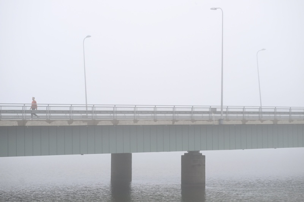

Dense fog covered the Lauttasaari Bridge in Helsinki on the morning of Friday, 5 September 2025. Photo: Mikko Stig / Lehtikuva
- Next Article IPI: Finnish media groups urge president to defend journalists in Gaza
Much of Finland is expected to experience summer-like warmth this weekend, though widespread fog and varying cloud cover may limit the highest temperatures.
According to the Finnish Meteorological Institute and private forecaster Foreca, a southerly air flow between a low-pressure system in the Atlantic and a high-pressure zone to the east is drawing warm, humid air into the region. Daytime temperatures could reach 24°C in southern and western parts of the country.
The warmest conditions are forecast for the western coastal region stretching from Southwest Finland to Ostrobothnia. Meteorologists say that in these areas, where morning fog is less likely, highs of 23–24°C are expected.
In contrast, thick fog blankets southern and eastern Finland, particularly Uusimaa, where early morning visibility dropped sharply on Friday. This fog, if persistent, may keep temperatures below 20°C in some areas.
“The situation in central Helsinki and along the south coast is uncertain,” said Henri Nyman, duty meteorologist at the Finnish Meteorological Institute. “Fog over the sea may drift inland, affecting temperatures.”
By late Friday morning, the fog had started to lift in many inland areas. If it clears fully, much of southern and central Finland could see temperatures between 21–24°C.
Foreca meteorologist Joonas Koskela said low clouds forming after fog dissipation may still prevent sunshine from heating the ground. “The sun is not as strong in September as in midsummer. Fog might rise from the surface but remain in the form of cloud.”
Saturday is expected to be largely dry nationwide, with patchy clouds in northern Finland and clearer skies further south. Any early morning fog is likely to dissipate by midday in most regions.
“Where the sun breaks through, we’re looking at widespread readings over 20°C,” Koskela said. “Locally, the 25-degree mark may be approached in the south-western parts of the country.”
Lapland is also forecast to remain warm for the season, with daytime temperatures ranging from 17–21°C, depending on cloud cover. Some northern locations could see near-record warmth for early September.
The weekend nights will be humid and still, creating conditions for renewed fog formation, especially in southern Finland. Any dense fog forming overnight is expected to lift gradually after sunrise.
Sunday will bring more changeable conditions. A frontal system approaching from the west could trigger rain and isolated thunderstorms, particularly in Western Finland during the afternoon. Elsewhere, the weather is expected to remain dry, though cloud cover will increase.
The weather on Sunday evening is of special interest due to a total lunar eclipse, visible across Finland shortly after sunset.
“Forecasting cloud cover for the eclipse is difficult,” said Eevi Silvennoinen, meteorologist at the Finnish Meteorological Institute. “Current models suggest eastern and central areas may have clearer skies, while the west and north are likely to be cloudier.”
The eclipse, expected to begin soon after sunset, will be total and visible from all parts of the country, weather permitting.
The warm conditions are forecast to continue into the early part of next week, with temperatures remaining above 20°C across much of the country. On Monday and Tuesday, southern Finland may again see highs approaching 24°C.
By midweek, however, the Atlantic low-pressure system may bring widespread rainfall, with some regions likely to experience more persistent showers.
HT
- Next Article IPI: Finnish media groups urge president to defend journalists in Gaza
Source: www.helsinkitimes.fi